
.webp)


Designing Safer Streets: How Connected Technologies are Reimagining Roadway and Biking Safety

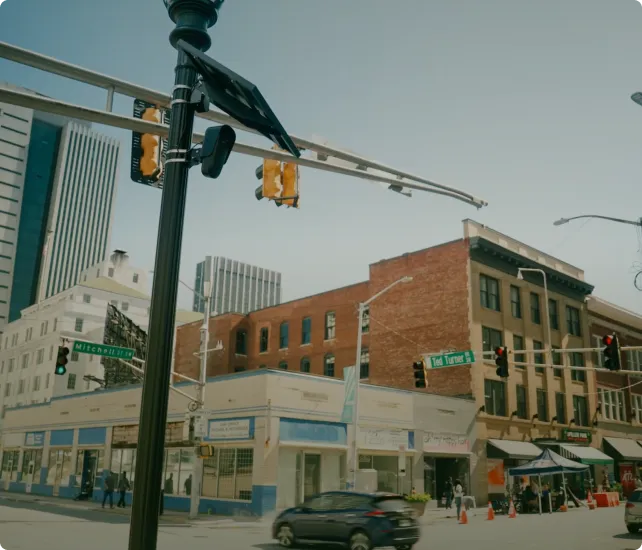
As cities across the country grow denser, more diverse in transit needs, and more complex in traffic patterns, traditional approaches to roadway safety are no longer enough. Communities need safer intersections, better protected bike lanes, and smarter responses to dangerous driving and car crashes. To answer that call, forward-looking city leaders and law enforcement agencies are embracing an interconnected approach to traffic and public safety—one that leverages technology not just to react, but to proactively design safer streets for everyone.
Flock Safety’s ecosystem of traffic analytics, license plate reader (LPR) cameras, DFR, and Real Time Crime Centers (RTCCs) is equipping agencies and cities with the tools to see more, understand faster, and take meaningful action. Together, these technologies are helping create environments where people feel safer driving, walking, and biking—no matter the neighborhood.
The New Traffic Safety Imperative
Traffic fatalities in the U.S. remain alarmingly high. The U.S. Department of Transportation’s National Highway Traffic Safety Administration (NHTSA) estimates that more than 39,000 people died in traffic crashes in 2024. In particular, cities are grappling with a troubling rise in pedestrian and cyclist deaths, often caused by speeding, reckless driving, or blind intersections that offer no room for error. NHTSA also reports, “For the last 5 years (2017 to 2021), the yearly average has been 883 people on bicycles killed in police reported traffic crashes.”
But there's not always a clear path for local leaders to identify the problem areas and implement changes. Historically, they’ve lacked the data to act with confidence.
Enter Flock Traffic Analytics, a solution that empowers officials with accurate, real-time insights into vehicle volume, speed trends, and traffic flow. But this data doesn’t live in a silo. It is most powerful when connected with broader safety infrastructure.
A Layered Approach to Roadway Safety
Here’s how cities can combine Flock’s traffic technology with their broader public safety network to build safer roadways:
Traffic Analytics: Smarter Planning Starts with Smarter Data
Using Flock’s AI-powered traffic insights, city planners and police departments can:
- Pinpoint high-speed corridors and intersections prone to dangerous driving
- Quantify the impact of road design changes (e.g., adding a stop sign or speed bump)
- Understand vehicle volumes over time to plan safe pedestrian crossings or protected bike lanes
This data can be exported and visualized to guide grant applications, shape policy, and inform public works projects.
LPR and Crash Prevention: Identifying Risk in Real Time
License plate reader cameras add another layer of protection, especially when placed near high-risk corridors. LPR alerts can identify:
- Vehicles with histories of reckless driving or suspended registrations
- Repeat offenders involved in hit-and-run incidents
- Patterns of vehicles speeding through school zones or park areas
By layering LPR insights over traffic analytics, officials gain both macro and micro views of roadway behavior and are able to track long-term trends while responding to acute risk.
Drones as First Responders: Faster Eyes on the Scene
Drone as First Responder (DFR) programs offer agencies the ability to assess accidents, monitor congestion, and deliver situational awareness in real time. Whether responding to a traffic collision, surveying a construction zone, or supporting a parade route, drones help:
- Reduce emergency response times
- Provide overhead visuals of crash scenes for better on-the-ground coordination
- Prevent secondary accidents caused by sudden slowdowns or poor visibility
In bike-heavy corridors, drone coverage can also verify safe behavior by both drivers and cyclists, supporting proactive safety messaging and enforcement.
RTCCs: The Nerve Center of Public Safety
Real-Time Crime Centers unify all these technologies. From video feeds to LPR data to drone footage and traffic metrics, they’re all combined into a central hub in FlockOS. From here, analysts and command staff can:
- Watch emerging threats unfold across multiple intersections
- Coordinate cross-agency responses (public works, police, EMS)
- Drive faster data-sharing with DOT partners and transportation departments
Additionally, RTCCs provide the capability to leverage live video for real-time crash impact assessment and recorded video to understand the true sequence of events leading up to a collision. This combination eliminates the need for time-intensive manual reconstruction based on skid marks, vehicle positions, or unreliable eyewitness accounts.
With footage from integrated video cameras, data from traffic analytics, and quick-on-scene-coverage from drones, officials can quickly determine cause, fault, and opportunities for future mitigation. This not only accelerates investigations but also improves accuracy; transforming how cities manage post-crash procedures and make policy decisions to prevent similar incidents in the future.
The Interconnected City: More Than the Sum of Its Parts
By itself, no single device can fix road safety. But together, an ecosystem of smart, connected tools transforms the way cities prevent accidents, protect vulnerable road users, and respond to emergencies. This interconnectedness is the new standard for urban safety—one where public safety doesn’t start when a call comes in, but long before, through insight and action.
Whether it’s reducing dangerous driving near parks, identifying hot spots for collisions, or planning the next generation of bike-friendly infrastructure, Flock’s integrated traffic safety solutions help communities take a data-informed, people-first approach to roadway design.
Conclusion: Safer Roads Begin with Shared Intelligence
When every piece of the city’s safety puzzle communicates—when traffic cameras talk to license plate readers, when drone footage feeds into a real-time dashboard, and when all of it supports evidence-based decision making—the result is not just fewer crashes. It’s greater confidence in local leadership, better quality of life, and roads that truly serve everyone who uses them.
Discover more about how Flock Traffic Analytics is helping government agencies design safer communities at flocksafety.com/traffic-analytics-government.


Protect What Matters Most.
Discover how communities across the country are using Flock to reduce crime and build safer neighborhoods.