
.webp)


From Detection to Coordination: A New Model for Law Enforcement Response
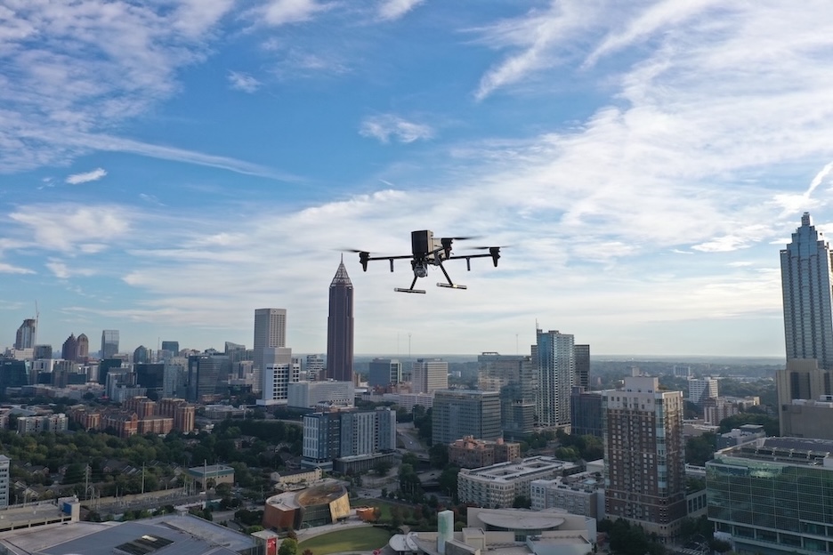
Public safety agencies are increasingly connecting Drone as First Responder (DFR), license plate readers (LPR), and video into a single operational workflow, giving teams the visibility, context, and intelligence they need to respond faster and make better decisions before officers arrive on scene.

The Shift From Detection to Coordinated Response
Public safety teams rarely struggle because they lack information entirely. More often, the challenge is that information arrives in pieces.
A license plate reader (LPR) may detect a vehicle connected to prior incidents. A nearby camera may capture activity around the scene. A Drone as First Responder (DFR) may launch after a call comes in. Responding officers may receive updates from dispatch while assessing conditions in real time.
Each system can be effective on its own. The greatest operational value emerges when those systems work together, creating a coordinated flow of intelligence that helps agencies move from awareness to action with greater speed and clarity.
This shift is increasingly important as agencies face growing demands on limited staffing resources. High-priority areas still require consistent coverage, rapid response, and reliable situational awareness, yet many jurisdictions are being asked to accomplish more with the personnel they already have.
This challenge is especially common in high-activity environments, such as busy corridors, retail districts, parking lots, entertainment areas, transportation hubs, and large commercial properties, where incidents unfold quickly and conditions change minute by minute.
In these environments, success is rarely determined by a single alert, camera, or responding unit. It comes from how effectively information is shared, verified, and acted upon across the entire response workflow.
The agencies seeing some of the strongest operational outcomes are increasingly moving toward a connected approach in which LPR, video, and DFR capabilities function as part of a single system rather than separate technologies.
Detection alone rarely tells the full story.
Detection With Context Creates Better Decisions for Law Enforcement
An LPR alert can identify a vehicle entering an area, but that alert immediately raises additional questions.
Is the vehicle still on scene? Is the activity routine or suspicious? How many people are involved? Has the situation escalated? Which direction is the vehicle moving now?
The faster those questions are answered, the sooner agencies can determine the most appropriate response, which is where integrated systems begin to transform operations.
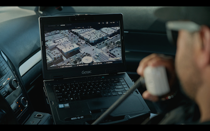
Video helps confirm what is happening at the time of the alert. DFR extends visibility beyond fixed camera positions, providing live aerial awareness as the incident unfolds. Rather than relying on separate updates from multiple systems, operators and responding officers can access a more complete operational picture from the start. The result is a faster, more informed response.
For agencies operating a DFR program, the impact can be significant. Flock customers using DFR reach calls for service in an average of 86 seconds or less, providing critical intelligence while incidents are still developing. In many cases, teams can assess conditions, verify information, and support decision-making before officers arrive on scene.
Visibility also helps agencies allocate resources more effectively. Across DFR deployments, one in five calls has been resolved without dispatching patrol, allowing agencies to clear calls appropriately while keeping officers available for incidents that require an in-person response.
When systems work together, agencies spend less time gathering information and more time acting on verified intelligence.
Operational visibility is one of the themes highlighted by the Elk Grove Police Department in its DFR program. In discussing how LPR and aerial response work together, the department describes the value of identifying a vehicle on the ground and quickly gaining live aerial visibility while the incident is still developing. The result is faster response and better situational awareness before officers arrive on scene.'

An Example of Coordinated Coverage in Practice
Consider a vehicle tied to an organized retail theft investigation entering a monitored commercial area.
An LPR system immediately identifies the vehicle based on a prior BOLO or investigative alert. Nearby video confirms where the vehicle stopped, whether occupants exited the vehicle, and what activity is occurring around the scene. At the same time, a drone provides live aerial visibility across parking lots, adjacent roadways, and nearby gathering points before officers arrive.
That layered visibility changes the quality of decision-making.
Responders are no longer relying on a single alert or static snapshot. They can understand movement patterns, direction of travel, traffic conditions, crowd dynamics, and developing activity in real time.
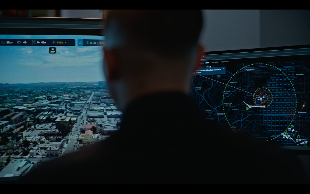
As the incident unfolds, intelligence continues to build. Dispatch gains greater situational awareness. Supervisors have more information to guide deployment decisions. Officers receive valuable context before making contact. Everyone involved is operating from the same evolving picture.
For agencies managing large coverage areas or limited staffing resources, operational clarity becomes even more valuable.
Visibility gaps often emerge across wide geographic areas where incidents move beyond the reach of a single camera, patrol unit, or technology platform. Connecting aerial and ground-based intelligence helps agencies maintain awareness across larger areas while ensuring critical information reaches the right people at the right time.
The Dunwoody Police Department demonstrated this during a high-risk incident involving an armed suspect. After a neighboring agency issued a BOLO, Flock LPR helped narrow down the suspect vehicle's location. Dunwoody then deployed DFR to locate the suspect visually and guide officers safely to the scene. The suspect was taken into custody without injuries to officers, civilians, or the suspect.
The workflow was highly coordinated. LPR identified the lead, and DFR provided live situational awareness. Responders arrived with a clearer context before engaging.
Air and Ground Intelligence Work Better Together
This shift is also changing how agencies think about air and ground coverage.
For years, aerial response systems and ground-based technologies were often deployed through separate workflows. Today, agencies are increasingly recognizing that these technologies contribute to the same operational objective: delivering timely intelligence that supports safer, more informed responses.
LPR helps identify activity. Video helps verify it. DFR helps maintain visibility as conditions evolve.
Together, these capabilities create a more complete understanding of what is happening before responders arrive on scene.
The impact extends beyond incident response. Agencies gain broader awareness across high-priority areas, stronger operational continuity between dispatch and field personnel, and greater confidence that critical information is reaching officers before they make key decisions.
DFR programs have also demonstrated measurable results in helping agencies locate individuals more quickly. Flock customers have reported an 89% increase in the number of subjects located, enabling teams to cover more ground, maintain visibility as situations evolve, and share critical intelligence across responding units.
That value extends beyond law enforcement to public safety organizations and security teams managing large campuses, logistics facilities, retail centers, transportation hubs, and other complex environments where maintaining awareness across wide areas is essential.
The broader trend across public safety technology is becoming increasingly clear: organizations are moving toward coordinated systems that support detection, verification, and response as a unified workflow.
The value came from faster deployment and actionable intelligence before officers arrived on scene.
Building a More Complete Safety Shield
As agencies evaluate how to strengthen coverage in their highest-priority areas, many are looking beyond individual technologies and focusing on how they work together.
That thinking is the foundation behind Rapid Response Shield, a purpose-built approach that combines technology across air and ground, creating a persistent, always-on layer of coordinated intelligence across the areas that need it most. By connecting DFR, LPR, and video into one coordinated system, it helps agencies replace fragmented workflows with a clearer, faster path from detection to informed response across up to 20 square miles.
Rather than managing separate workflows, agencies can unify aerial awareness, ground-based detection, and real-time video intelligence into a single operational picture. The result is broader visibility, faster access to actionable information, and greater confidence in decision-making from dispatch through response.
In high-risk environments, effective coverage comes from connecting the systems that support detection, visibility, and response.
Let's Talk
See how coordinated air and ground response can help your agency expand coverage, accelerate response times, and deliver greater situational awareness across your highest-priority areas.


Protect What Matters Most.
Discover how communities across the country are using Flock to reduce crime and build safer neighborhoods.