
.webp)







Search and Rescue Drones: Faster Response When Seconds Count
Search and rescue drones work best as part of a connected Drone as First Responder (DFR) system rather than as standalone hardware, giving public safety teams earlier aerial visibility and better coordination during urgent calls.

Search and Rescue Drone Response for Public Safety Agencies
Urgent rescue calls rarely arrive with a clean map. A missing person may be moving, a caller may not know the exact location, and terrain, traffic, darkness, water, or weather can slow the first ground unit. A search and rescue drone helps public safety teams gain aerial visibility sooner, so dispatch, command, field responders, and partner agencies can work from a clearer picture while decisions are still being made.
Flock does not sell a standalone rescue drone. Flock provides the Aerodome DFR system, an end-to-end Drone as First Responder system that connects drone launch, live aerial video, dispatch and RTIC operations, responder coordination, flight records, mission reports, and implementation support.
The aircraft and camera are important. For public safety, the operating system that supports them is just as critical. DFR helps trained teams get eyes on scene first, share live context with the right personnel, and make safer, more informed decisions before or as ground responders arrive.
For law enforcement, fire departments, EMS agencies, emergency management, and regional partners, the goal is not to replace field judgment. The goal is to help the people responsible for safety see earlier, coordinate with fewer blind spots, and maintain a clearer record of what happened and why.
Why Speed and Visibility Are Critical During Rescue Calls
Rescue calls often begin with uncertainty. Dispatch may have an incomplete location. The person may be injured, disoriented, hidden from view, or difficult to reach on foot. Ground teams may be choosing among several access points before anyone has a full view of the scene.
A drone can help answer practical questions while responders are still en route:
- Where should teams begin the search?
- Which route is safest for officers, firefighters, EMS, or search teams?
- Are there nearby hazards, traffic issues, water, fire conditions, or terrain barriers?
- Should partner agencies stage differently?
- Does the first report match what is actually happening?
Aerodome DFR delivers an average 71% reduction in response time and clears 20% of calls without deploying patrol units. These are program proof points, not guarantees for every agency or incident. They demonstrate the value of making drone response part of the operating model, rather than treating it as a separate tool brought in after the fact.
Faster aerial awareness can help teams narrow a search area, reduce unnecessary exposure, assess hazards from a safer distance, and coordinate the next move with more confidence. Flock’s resources on public safety drones and emergency response drones explain how live aerial context supports urgent public safety incidents without turning the drone into the decision-maker.
How Search and Rescue Drone Response Works in a DFR System
A search and rescue drone is most useful when launch, live video, access, documentation, and review are connected. The Aerodome DFR system is built for a connected response, not for organizations that want to buy drone hardware and assemble the rest themselves.
A typical DFR response may look like:
- A 911 call, alert, dispatcher request, or operator need initiates a drone response under agency policy.
- Trained personnel launch through the DFR system using approved procedures.
- The drone travels to the area and streams live video. Thermal, infrared, zoom, or low-light visibility may be available depending on the deployed configuration.
- Dispatch, RTIC or RTCC staff, command, field responders, and partner agencies can view the same operational picture when access is configured.
- Responders use the feed to locate a person or vehicle, assess hazards, plan approach routes, stage resources, document scene conditions, or clear a call when appropriate.
DFR separates itself from a standalone aircraft at the handoff point. A drone can provide a view. A DFR system helps public safety teams get the right view to the right people, preserve records, reduce manual coordination, and keep operations aligned with local policy.
This overview of law enforcement drones gives additional context on how agencies use DFR for faster response, live aerial awareness, and coordinated operations.
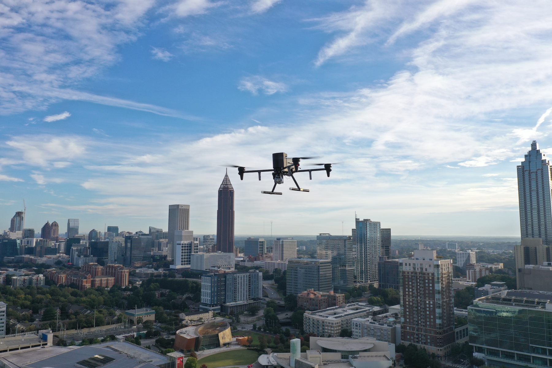
Search and Rescue Use Cases for Public Safety Drones
Search and rescue drone programs support public safety teams when location, visibility, terrain, or time makes the response more difficult. The drone helps incident command and trained responders narrow the search, understand scene conditions, and determine where to deploy ground resources next.
Common rescue and urgent-response scenarios include:
- Missing-person searches where a person may be moving, disoriented, injured, or difficult to see from the ground.
- Urgent welfare calls involving children, older adults, or vulnerable people when location details are incomplete.
- Large-area sweeps across parks, trails, parking lots, open land, or mixed urban and rural environments.
- Wooded, hilly, fenced, or hard-to-access terrain where teams need safer routes in and out.
- Nighttime or low-visibility searches where thermal or infrared tools may support assessment where configured.
- Accident scenes where command needs an overhead view of traffic, hazards, ingress, and egress.
- Fire, EMS, and law enforcement coordination when crews need to understand staging, access, or risk before committing resources.
- Flood-adjacent, evacuation, or severe-weather response where aerial awareness can help teams understand changing access routes.
- Regional or mutual-aid operations where a shared live picture can support law enforcement, fire, EMS, emergency management, and partner agencies.
Public safety drones do not replace officers, firefighters, EMS clinicians, search teams, or command judgment. They give those teams earlier, better visibility, and then people decide what the information means and what the safest next step is.
Thermal and Infrared Visibility Help Teams Search Smarter
Thermal and infrared sensors can be valuable in search-and-rescue drone operations, especially when a person is hard to see because of darkness, distance, terrain, vegetation, or weather. When properly supported and configured, these tools can help operators detect heat signatures, improve nighttime visibility, and assess areas that would take much longer to search on the ground.
A UAV equipped with thermal imaging, infrared visibility, zoom, or low-light capabilities can help teams review fields, wooded areas, drainage corridors, parking lots, rooftops, and other challenging search environments from a safer distance.
Sensors still need the right operational path. The value increases when the feed reaches dispatch, command, field units, and partner agencies quickly, with access governed by agency policy and mission records available afterward. That is why Flock frames drone response around the full DFR system, not the payload alone.
Flock’s emergency response drone resources explain how live aerial video and shared scene context help responders understand conditions earlier and coordinate with more confidence.
What Agencies Should Evaluate Before Launching a DFR Program
Agencies evaluating a search-and-rescue drone should assess the entire DFR program, not just the aircraft. Hardware matters, but the harder questions usually involve readiness, staffing, airspace, training, access, records, and public trust.
Command staff, drone program leaders, RTIC teams, fire leaders, EMS partners, emergency managers, and city officials should evaluate:
- Launch criteria should define which calls qualify for drone deployment and who can approve or initiate launch.
- Deployment model should account for remote operations, docking, battery support, weather considerations, coverage area, and jurisdiction needs.
- Live video access should clarify which roles can view feeds, on which devices, and under what conditions.
- Sensor capabilities should match operational needs, including thermal, infrared, zoom, night-vision, and payload options where supported by the selected system.
- Operational integrations should support CAD, dispatch, RTIC or RTCC tools, and other public safety systems where supported and necessary.
- FAA and legal readiness should address airspace requirements, FAA regulatory work, state-law considerations, and local documentation.
- Training and sustainability should include operator training, standard operating procedures, supervision, support, and ongoing program management.
- Records and review should cover flight logs, mission reports, retained media, access controls, auditability, and evidence handling.
- Community communication should include public-facing information, transparency tools, and clear explanations of use and safeguards.
- Regional growth should account for mutual aid, cross-agency coordination, and the ability to scale across jurisdictions.
Buying drone hardware alone can leave agencies with gaps in policy, staffing, airspace coordination, training, live access, and recordkeeping. A DFR system is stronger when it helps the agency explain what flew, why it launched, who could view the feed, what was retained, and how to review the mission.
Accountable Drone Response Starts with Local Control
A responsible DFR program should be clearly defined before the first flight. Agencies should define the program's purpose, which incidents qualify, who can operate the system, who can view live video, how records are handled, and how the agency complies with FAA requirements and applicable state law.
Accountability is not a communications add-on. It is integral to making drone response lawful, understandable, and reviewable.
City leaders and command staff should be ready to answer practical questions:
- What public safety purposes does the program serve?
- Which personnel are trained and approved to operate the system?
- Which roles may view live video during a mission?
- How are flight logs, mission reports, and retained media handled?
- How does the agency document compliance with FAA requirements and state law?
- How will the agency communicate with residents about use, outcomes, and safeguards?
Aerodome DFR includes flight logs and mission reports, along with a community dashboard that can automatically populate redacted DFR flight details and success metrics where supported. Flock’s broader approach to privacy and trust emphasizes local control, accountable use, and technology that supports human decision-making.
How Aerodome DFR Supports Search and Rescue Response
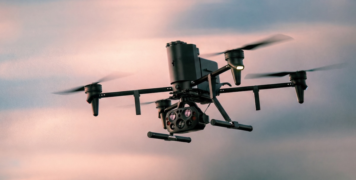
Aerodome DFR supports search and rescue response by integrating drone hardware, flight operations software, live streaming, mobile access, integrations, training, regulatory support, and accountability tools into a single DFR system. The result is a program model that agencies can operate, explain, and review, not just an aircraft they can launch.
Depending on agency needs, jurisdiction, airspace, and selected configuration, the system can include:
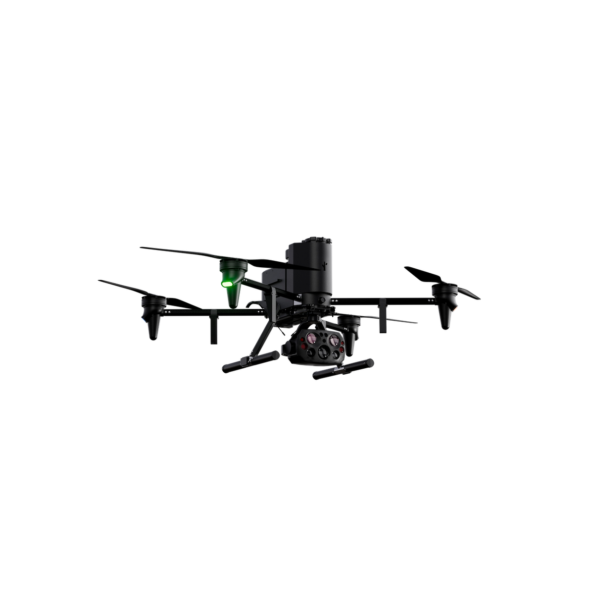
- Drones with advanced payloads.
- Automated docking stations.
- Airspace awareness tools.
- Flight operations software.
- Real-time telemetry and live video streaming.
- Mobile access for field personnel.
- Flight logs and mission reports.
- Integrations with existing technology.
- FAA regulatory work and safety planning.
- SOP and policy consulting.
- Comprehensive DFR training.
- Community engagement support.
The broader Flock ecosystem can also add context when a rescue or urgent welfare call involves other public safety signals. For example, license plate reader cameras may provide vehicle context in certain incidents, while DFR provides live aerial visibility. The drone remains one part of the response, connected to the systems and people already responsible for the call.
Aerodome is built for agencies that need more than an aircraft. It helps teams launch using defined procedures, see sooner, coordinate across roles, and review the mission afterward.
Agencies can explore Aerodome DFR or talk with an expert to understand how DFR could fit their rescue response, dispatch, RTIC, and regional coordination needs.
Field Example: Corona PD and Real-Time Aerial Intelligence
A documented Corona PD incident demonstrates the operational value of rapid aerial visibility during a rescue call, without turning one example into a universal promise.
During a call about a baby locked inside a hot car, Corona PD used DFR to locate the vehicle from above and relay its exact location to responding officers.
“We were able to provide the information exactly where that vehicle was, so our officers on the ground could respond there quickly and get the baby out of the vehicle,” said Corona PD Community Service Officer Matthew Hindman in this Aerodome DFR in Action profile.
The operational point is clear: aerial visibility helped responders avoid searching under pressure and move directly to the right location. Other incidents will vary by call type, geography, staffing, policy, and airspace, but the example shows why shared location information and live aerial context can matter during high-urgency calls.
Corona’s model also reflects the role of real-time operations. DFR pilots, dispatch, officers, and real-time information staff can work from a shared view of the scene, giving responders clearer context before they act.
FAQs
How Do Search and Rescue Drones Work for Public Safety Agencies?
Search and rescue drones provide public safety teams with live aerial visibility during urgent incidents, often before or as ground responders arrive. Within a DFR system, a 911 call, alert, dispatcher request, or operator need can trigger a launch under agency policy, stream live video to approved personnel, support coordination between dispatch and field teams, and create reviewable mission records.
What Should Agencies Evaluate When Choosing a Search and Rescue Drone?
Agencies should evaluate the entire DFR program, not just the aircraft. Key criteria include launch procedures, operator training, FAA and state-law readiness, live video access, thermal or infrared capability where supported, integrations, flight logs, data retention, access controls, auditability, community communication, and ongoing support.
How Can Drones Improve Public Safety During Search and Rescue Calls?
Drones can help responders see conditions sooner, narrow search areas, assess hazards, coordinate resources, and choose safer approach routes. A search-and-rescue drone is most useful when a connected, policy-governed system delivers the live aerial feed to dispatch, command, field responders, and partner agencies.
How Do Drones Support Fire Departments and Law Enforcement During Rescue Operations?
Drones can provide fire departments, law enforcement, EMS, and emergency management with a shared view of terrain, access routes, staging needs, hazards, and potential locations of a person or vehicle involved in the call. The drone supports trained responders and incident command. It does not replace firefighters, officers, EMS clinicians, search teams, or command judgment.
What Outcomes Can Agencies Expect From Deploying Rescue Drones?
A well-run rescue drone program can support faster awareness, stronger coordination, safer approach planning, and better documentation. Aerodome DFR customers report a 71% average reduction in response time and 20% of calls cleared without deploying patrol units. Outcomes vary by agency policy, geography, staffing, airspace, training, and incident type.
See how Aerodome supports faster response.
Sources
- https://www.flocksafety.com/products/flock-aerodome
- https://www.flocksafety.com/industries/law-enforcement
- https://www.flocksafety.com/blog/public-safety-drones
- https://www.flocksafety.com/blog/emergency-response-drone
- https://www.flocksafety.com/blog/law-enforcement-drones
- https://www.flocksafety.com/trust
- https://www.flocksafety.com/products/video-cameras
- https://www.flocksafety.com/book-a-demo
- https://www.flocksafety.com/blog/dfr-in-action-how-corona-pd-uses-drones-for-life-saving-rescues


Protect What Matters Most.
Discover how communities across the country are using Flock to reduce crime and build safer neighborhoods.